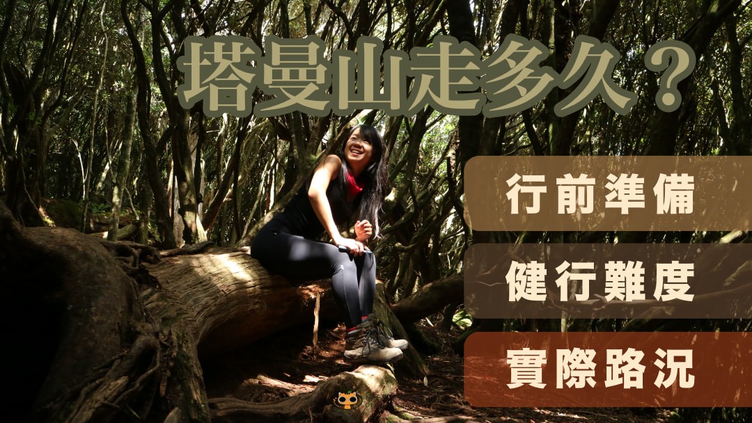
Travel blog
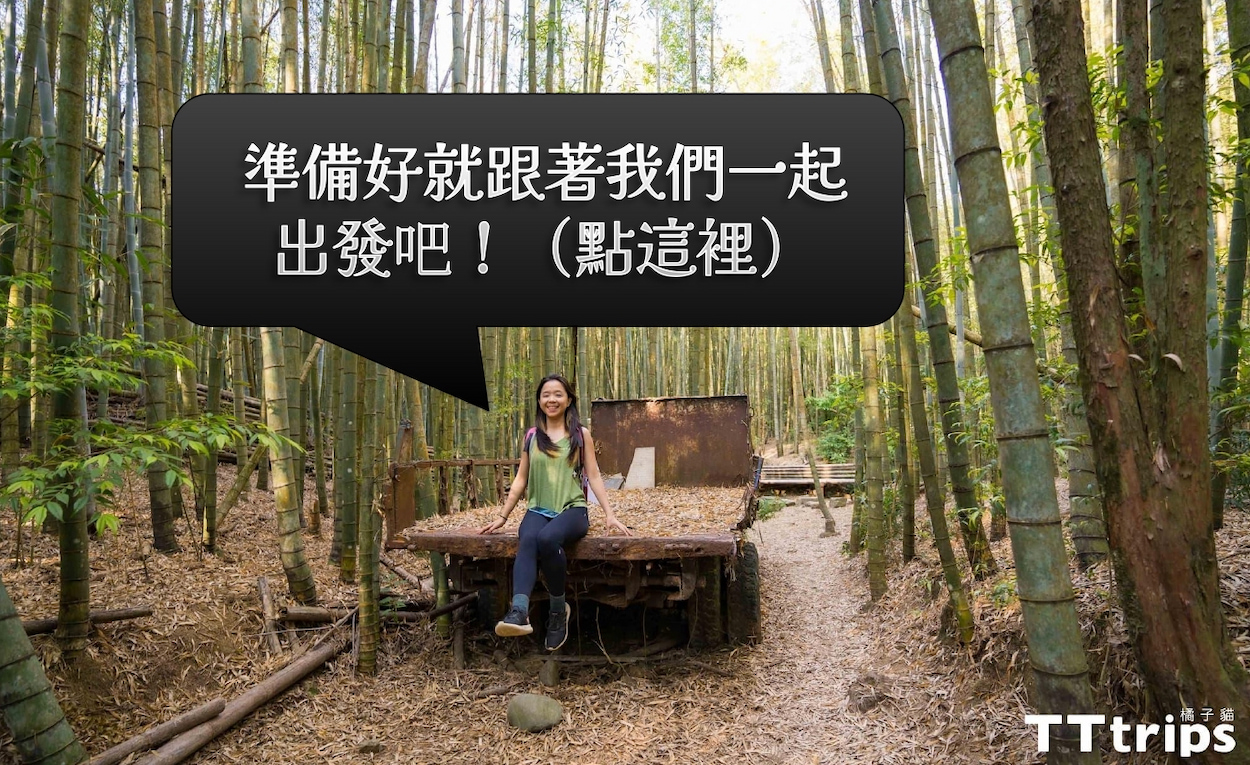
Want to feel the feeling of being surrounded by forests? Just come to Changshou Mountain!
Changshou Mountain, located in Heping District, Taichung City,
belongs to one of the tops of Yuanzui Mountain (Chouwei Mountain, Chouwei Mountain, Yuanzui Mountain).
Mountain, the lower difficulty Changshou Mountain is even more recommended to you!
 There is a whole piece of fir, cedar and Mengzhong bamboo forest waiting for you to find out.
(1).jpg)
More related climbing articles:
> Super entry Baiyue "Hehuan East Peak", conquered the first Baiyue in life!
> Taiwan Version of Mt. Fuji|Mt. Garry Hiking Trail One-Day Novice Hiking Route
Introduction to Changshou Mountain Trail
> Altitude: 1860 meters | The total length is about 2.3 kilometers
> Difficulty: ●●○○○| It takes about 3-4 hours for round-trip light loading
%20(1).jpg)
▲The triangle point of Changshou Mountain (Feiwei Mountain)
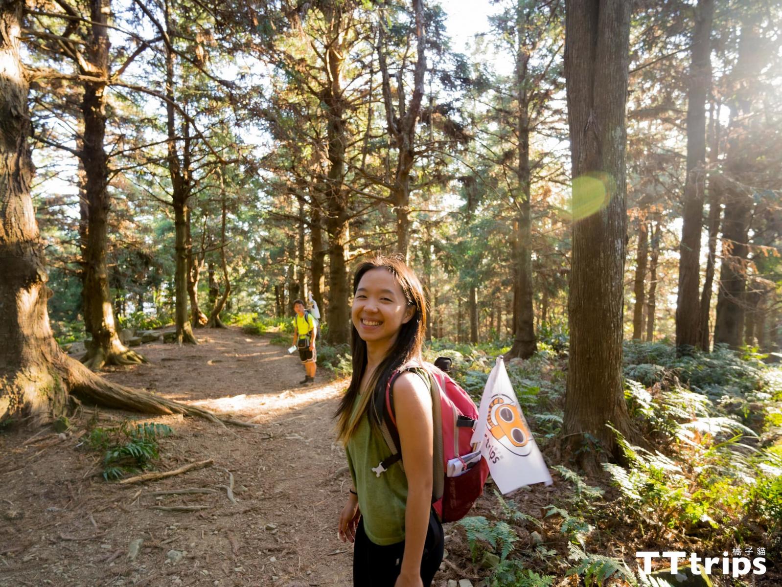
Changshou Mountain (not the Changshou Mountain of the Three Gorges!) is also called the 1860 Peak because it is 1860 meters above sea level. In the past, it was also called Feiwei Mountain. The height difference is about 620 meters. It only takes 3-4 hours to go back and forth. , very suitable for one-day hiking. The altitude rises from 1320 meters to about 1878 meters. The front part of the trail is the fir forest, the middle part is the Mengzhong bamboo forest, and the rear part is the mixed cedar forest. It has very rich forest features and the largest fir forest in Taiwan. Walking on the Longevity Mountain Trail full of phytoncide in summer is the most natural summer resort. In winter, it will not be too cold and very quiet due to the wind, and the longer you climb, the longer you will live! On the terrain, except that the last section before the triangle point is steep and requires a rope, most of the road conditions are very good (basic physical fitness is required).
.jpg)
▲A whole straight and towering cedar forest, the sun shines from the gaps in the leaves, it is really beautiful
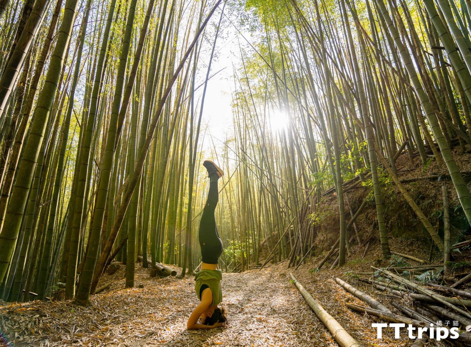
▲When staying in Mengzong Bamboo Forest, there will be a feeling of being surrounded by nature
▲It is said to be the largest fir forest in Taiwan. Walking in this forest, you can smell the fragrance of fir forest from time to time. The best phytoncide makes you relax without knowing it.
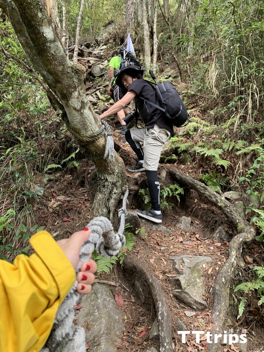
▲There is a relatively steep slope in the last section before the triangle point, but don’t worry, just pull the rope and step on it slowly and slowly
What's special about Changshou Mountain Trail
Going deep into the trail, you can find the abandoned iron ox cart hidden in the forest and the famous giant tree "Husband and Wife Tree", which is very mysterious. Enlarge the eyes a little, and there may be traces of blue-bellied pheasants! Changshoushan Mountain Trail is located at 19.8k of Daxueshan Forest Road (click ), which is an ancient abandoned forest road. Daxueshan Forest Road extends from Dongshi District to Heping District in Taichung. The drive from the central urban area is not too far away, and there is also a great opportunity to see the sea of clouds, and there are many trails that can be explored along the way, such as Changshou Mountain, Yuanzui Mountain, Hengling Mountain, Shaolai Mountain and Daxue Mountain Country. The forest recreation area, etc., are all worth visiting!
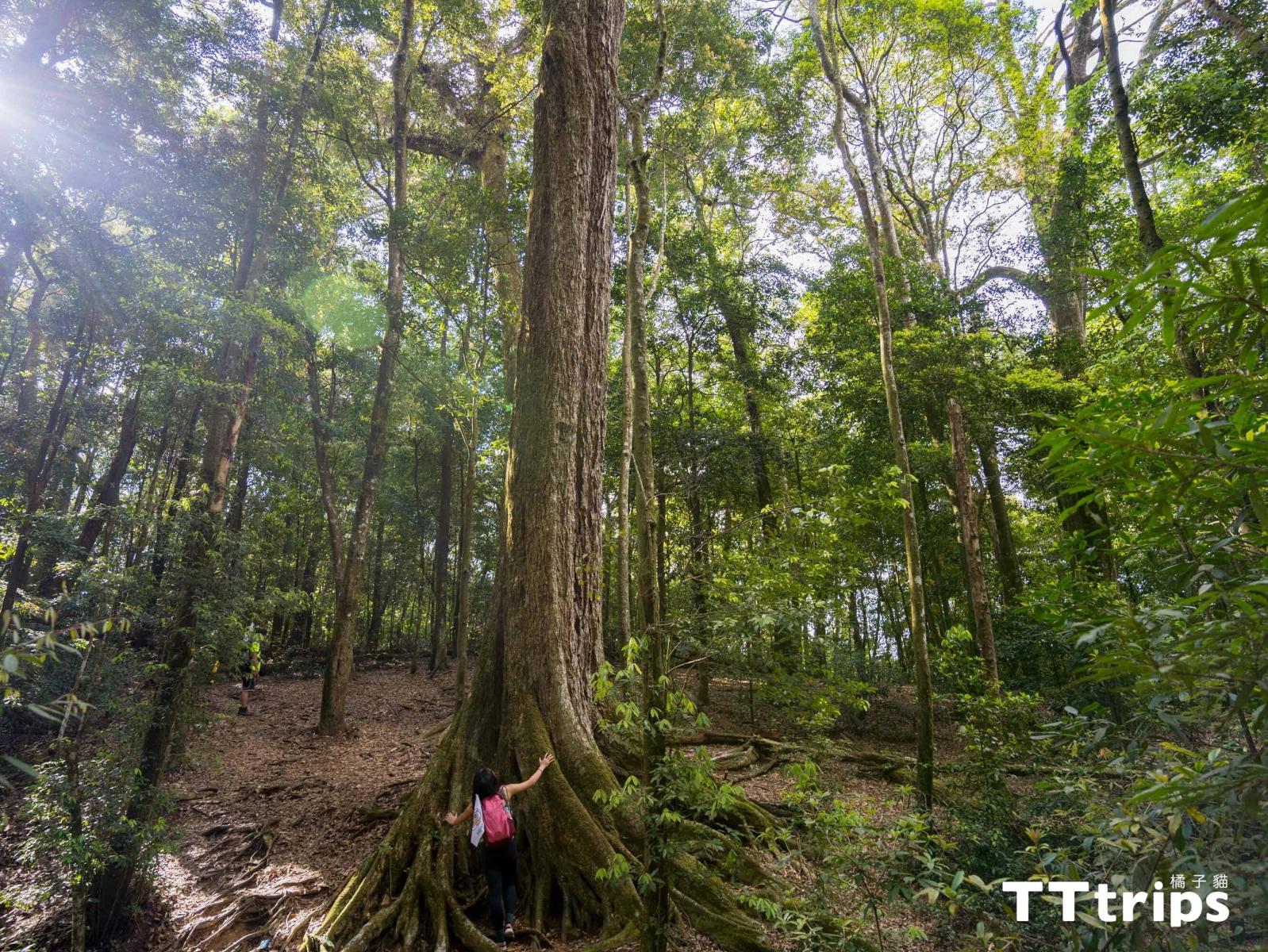 ▲You can see the huge couple tree after walking about ten minutes from the triangle point of Changshou Mountain
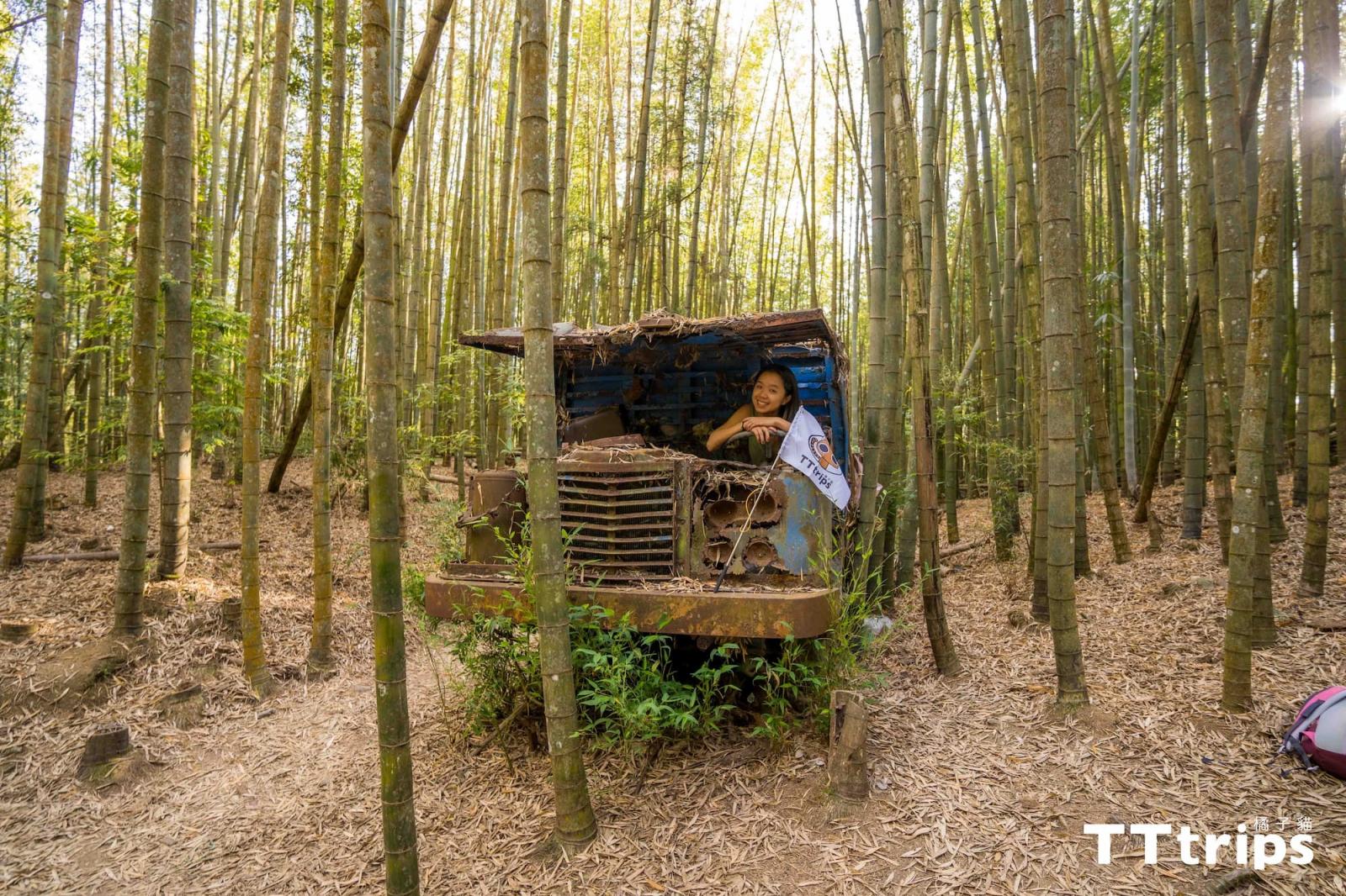
▲Abandoned cars (there are two!) are hidden in the bamboo forest of Mengzong, and the scene is very different. Be sure to check it out!
.jpg)
▲The entrance to the mountain (19.8k Daxueshan Forest Road) is near the green water tower, because there is no obvious sign, so don't miss it!
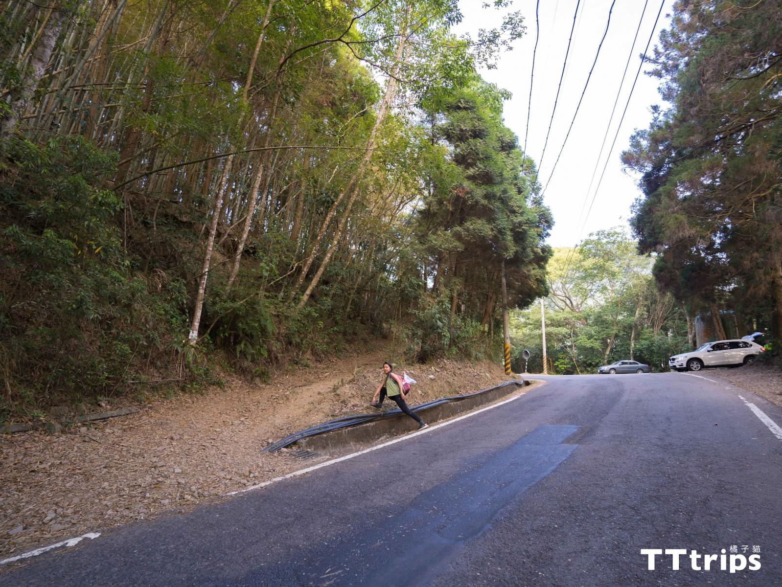
▲At the entrance of the mountaineering entrance (the green water tower is behind the people), most of the cars are parked on the roadside near the mountaineering entrance.
Other ways to play in Changshou Mountain - picnic in the forest, camping to see the night view, food
Because there are many resting places and artificial reclining chairs along the trail, it is also a great experience for everyone to carry food and have a picnic in the forest! (But remember to take the garbage down the mountain), and if you want to stay for another day after climbing the mountain that day, there are many great camping areas to choose from when you drive down the mountain for about 15-20 minutes from the Changshou Mountain trail! If you want to see the night view, you might as well stay an extra day. If you don’t buy food to go up the mountain, there are also several restaurants that you can try out by driving down the mountain for about 15-20 minutes from the mountain pass of Changshou Mountain (remember to ask the business hours first).
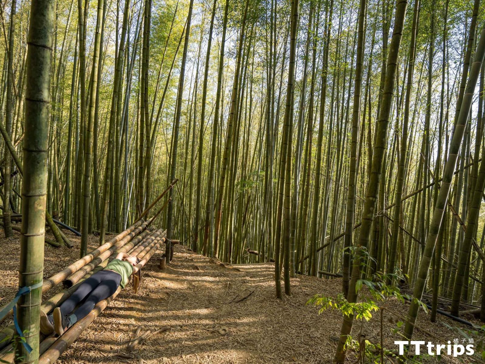
▲There are many artificial reclining chairs in the bamboo forest, just find one to lie down and look at the sky, there will be a feeling that you are also part of the forest
.jpg)
▲There are many open spaces and tables and chairs made of bamboo or stones along the way. Be sure to experience the feeling of carrying snacks or food up the mountain and then having a picnic in the forest (remember that the peeled kitchen waste does not fall to the ground)
Suggested route reference
[Novice] Climb only Changshou Mountain: 19.8K Mountain Trail → Xiangshan Forest → Mengzong Bamboo Forest → Longevity Mountain Triangle Point → Couple Tree → Back and forth on the original road (3-4 hours) Book here: Taichung Changshou Mountain Trail Day Tour | Xiangshan Uncharted
[Advanced Challenge] Yuanzui Mountain Xiling Line: 19.8K Mountain Entry → Xiangshan Forest → Mengzong Bamboo Forest → Longevity Mountain Triangle Point → Husband and Wife Tree → Weichou Mountain → Yuanzui Mountain → Yuanzui Slight Trail 27K Mountain Entry (6-7 hours) Book here: Taichung Yuanzui Xiling Trail Day Tour | Nature's Rock Climbing Field
How to get to Changshou Mountain?
Chartered Car: Please contact (Orange Cat Chartered Car Service) and we will have someone special to discuss with you.
By car [From Taipei]: Take the national highway south and drive in the direction of Taichung Shi. After arriving at Taichung Shi, enter Dongkeng Road, then connect to Daxueshan Forest Road, and stop at the vicinity of 19.8k. It is recommended to come early to have more parking spaces. (Destination: 24.243972, 120.921500)
Public transportation: Taichung Fengyuan Bus No. 251 (Taichung Shi Station - Hengliuxi Station), only three times a day (No. 251 bus schedule), after arriving at Hengliuxi Station, you need to walk about 7.4 kilometers (about one and a half hours) Arrive at the trailhead.
Precautions
1. Pay attention to the terrain: The ground of Changshou Mountain has a terrain with interlaced tree roots. Remember to wear medium or high hiking shoes with good grip to avoid spraining your feet or slipping!
2. Wuhen Mountain Forest: The closest toilet to the mountain entrance is Dadong Police Station, which is about a 15-minute drive away. It is not allowed to defecate anywhere in the mountains! If you have to, remember to dig a hole of at least 15 cm and bury it, and then take the toilet paper away. In addition, if you see garbage on the way back, you can take it down the mountain.
3. Practice basic physical strength before the trip: Although it is said that Changshou Mountain is less difficult, it is recommended to have basic physical strength. Before the trip, you can perform independent training such as running or cycling, maintain basic cardiopulmonary capacity and muscular endurance, and protect yourself. Respect for the mountains and forests, if you have bad knees, you can wear knee pads.
4. Prepare trekking poles: the so-called third foot in the legend, it is recommended to wear it to avoid slipping and can also disperse the weight of the body! If you don't have it, you can rent it in many places, so don't worry about the equipment.
5. Offline map: It is recommended to download an offline map even if there is a sound guide. The environment or weather on the mountain changes quickly, and being prepared can reduce the risk.
What to bring for a day hike?
Food: Action food, food, water
Clothing: Outer layer windproof and waterproof, middle layer warm clothes, inner layer sweat clothes, head warm and sun protection, hiking shoes
Row: Backpack, trekking poles, map
To bring but not necessarily to use: headlamp, rain gear, waterproof backpack cover, first aid kit, mosquito repellent
Personal items: wallets, medicines, toilet paper, power banks, garbage bags