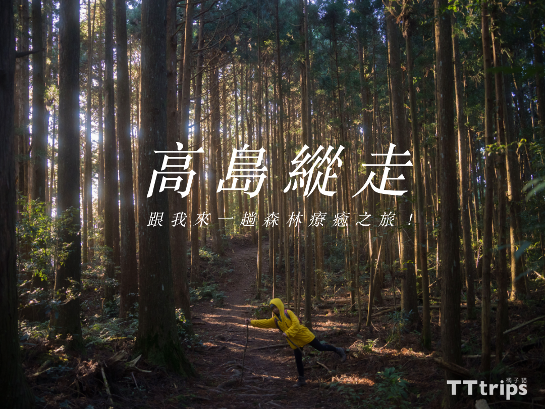
Travel blog
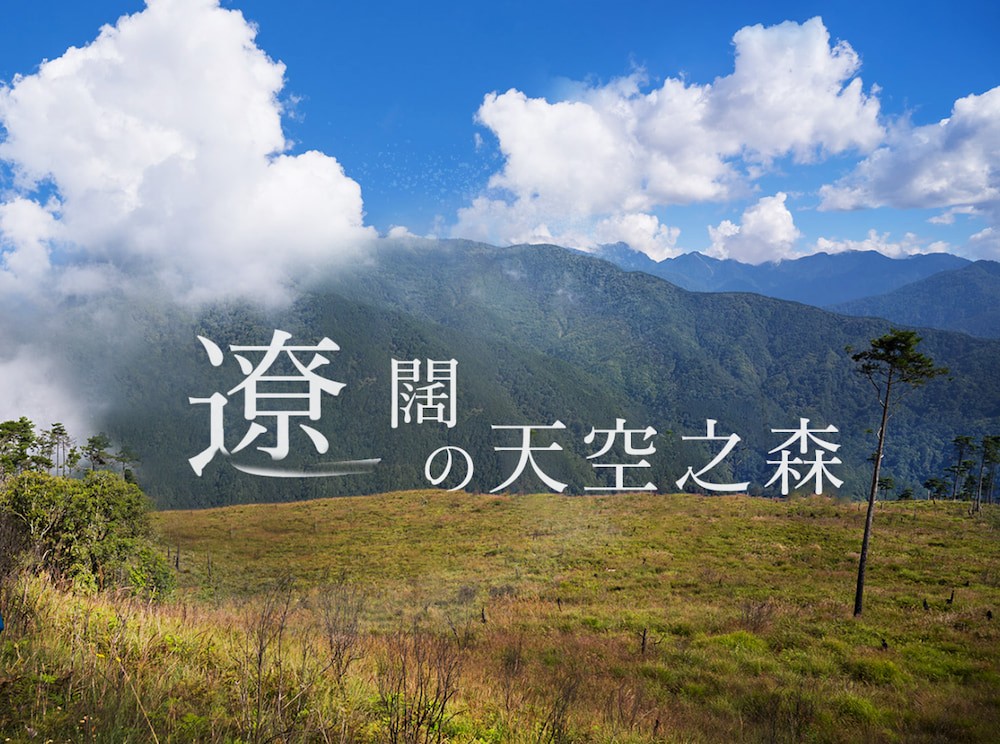
Walking on Takashima, more and more forest recuperation trips!
I often hear people say that exposure to nature is good for the body and mind. In the days after the epidemic, the Orange Cat team went into the mountains to collect a lot of materials, wrote articles, and shot a lot of Taiwanese mountain forest videos to share with you. Be grateful, because we are a travel agency and have the conditions to open groups, design products, and truly share the beauty in our eyes with you. I hope that in this technological era, we can keep our body and mind healthy together Forerver! In addition to enjoying the real nature spiritually, you can also exercise your body's health, and the more you move, the happier you are. The beauty of Takashima! Waiting for you to join in.
Latest departure time
Common problem
1. Offline map of Takashima Vertical Walk : Click me
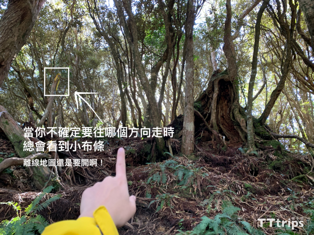
2. Are there many forks: about 5 are obvious. There are many small cloth strips along the way to climb the mountain, so you don’t need to worry about getting lost when you have an offline map ready. If you walk for a while and find out why it is getting harder and harder to walk, you may have taken the wrong route. Route, "turn back" directly to the original road, look at the offline map & find the climbing cloth, confirm it and then move on.
3. Do you need trekking poles or rain boots or hiking boots?攀繩要備手套嗎?建議準備一對登山杖+穿登山鞋+戴手套(怕手髒可以帶,但非必要)
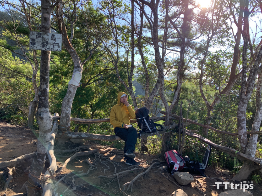
4. What is the best time for lunch break: Personal recommendation: Observation deck (with the best 180-degree view) > Cedar Woodland (suitable for camping & eating) > Koshimada
5. Weather see Windy:Click me
6. What is the latest time to start walking so that you can't finish walking? It takes about 7-8 hours to walk slowly, and it is recommended to board before 8:00 at the latest.
7. Terrain/difficulty? Earth-rock mountain trail, pine needle and fallen leaves road, tree root rock ridge road. Similar to Mount Garry, a little simpler than Mount Garry.
8. What are the important photo spots for the Takashima Long Walk? Hollow Odd, Gaotai Mountain Triangle Point, Cedar Woodland, Takashima Observation Deck, Koshimada Mountain, Nakashimada Mountain, Oshimada Mountain, Maple Leaf Area of Yaorao Road Section (December)
9. The nearest supermarket supply station to the mountain entrance (down the mountain): Click me
Transportation
1. By car (from Taipei): Take National Highway No. 3 and Zhongfeng Highway/Neishan Highway/Tai3 Line to Section 1 of Zhongshan Street/120 County Road in Hengshan Township, continue on County Road 120 and enter Jianshi Township Industrial Road. Follow the sign of "Gaotai Mountain Camping Area", and you will arrive at the first mountain climbing entrance of the destination and stop.
2. Mountaineering chartered connection: Order a chartered car service on the Orange Cat website before departure, and you can depart from your residence at the specified time and go directly to your destination.
The first mountain pass of Gaotai Mountain
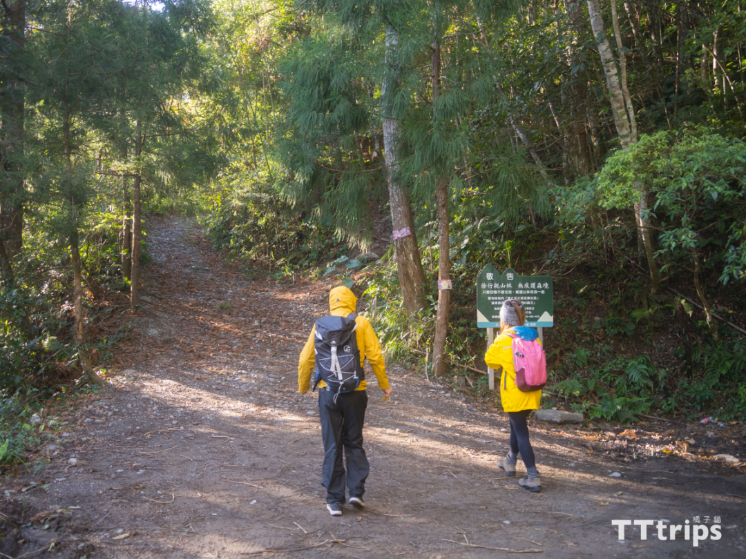
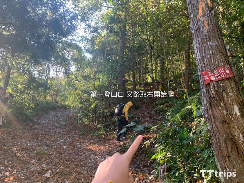
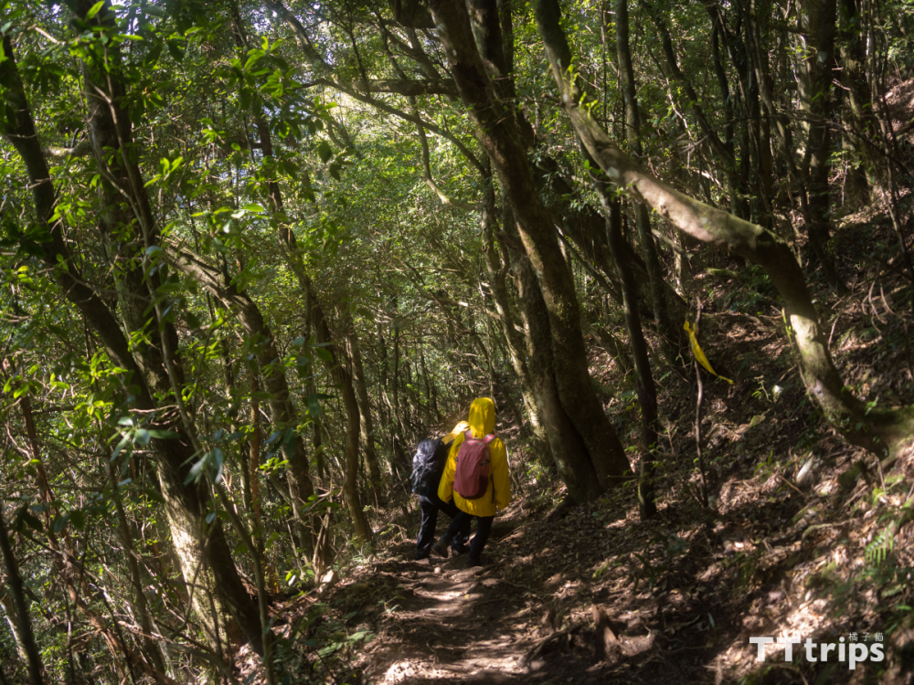
Takashima Longitudinal Walk refers to an intermediate mountain route connecting the four mountains from "Gaotai Mountain", "Oshimada Mountain", "Nakashimada Mountain" to "Oshimada Mountain", which is a good choice for a one-day vertical walk. There are three climbing entrances on Gaotai Mountain, namely the first, second and third. Most people will choose the first and second, because the third entrance is located in the camping area and belongs to private land. This time, we climbed from the first mountain entrance, and we immediately encountered a fork at the entrance. Be careful to enter from the right.
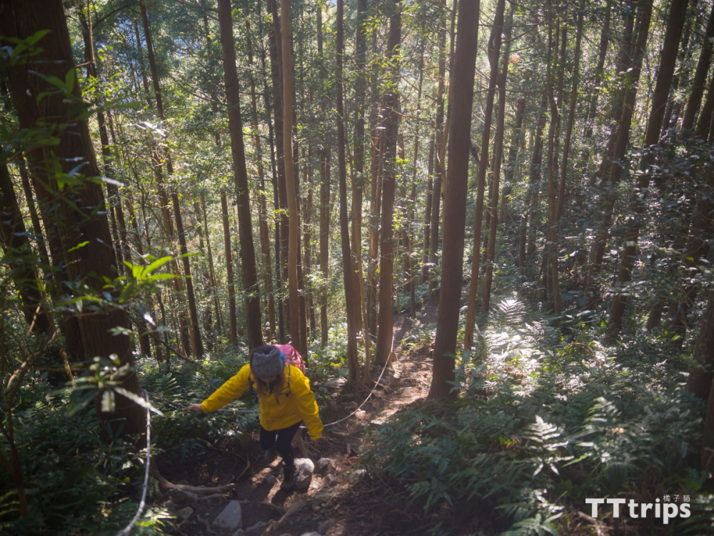
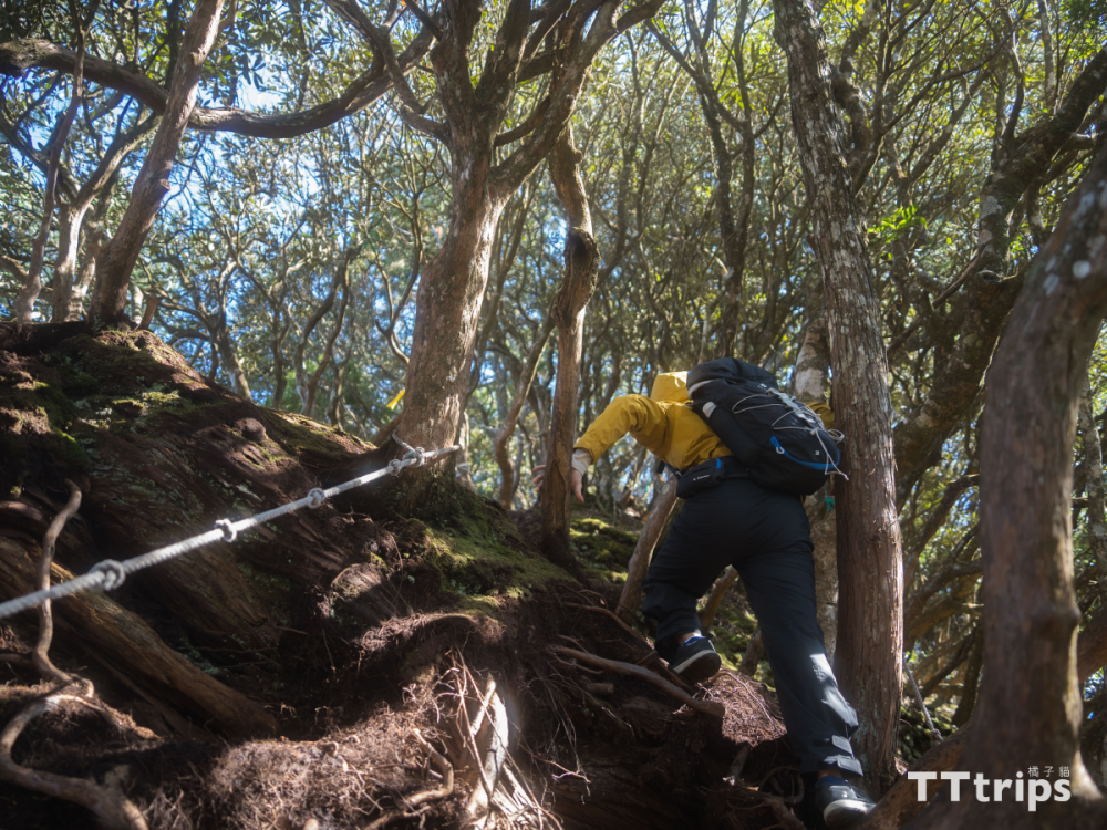
The steep climb into the mountain pass
.png)
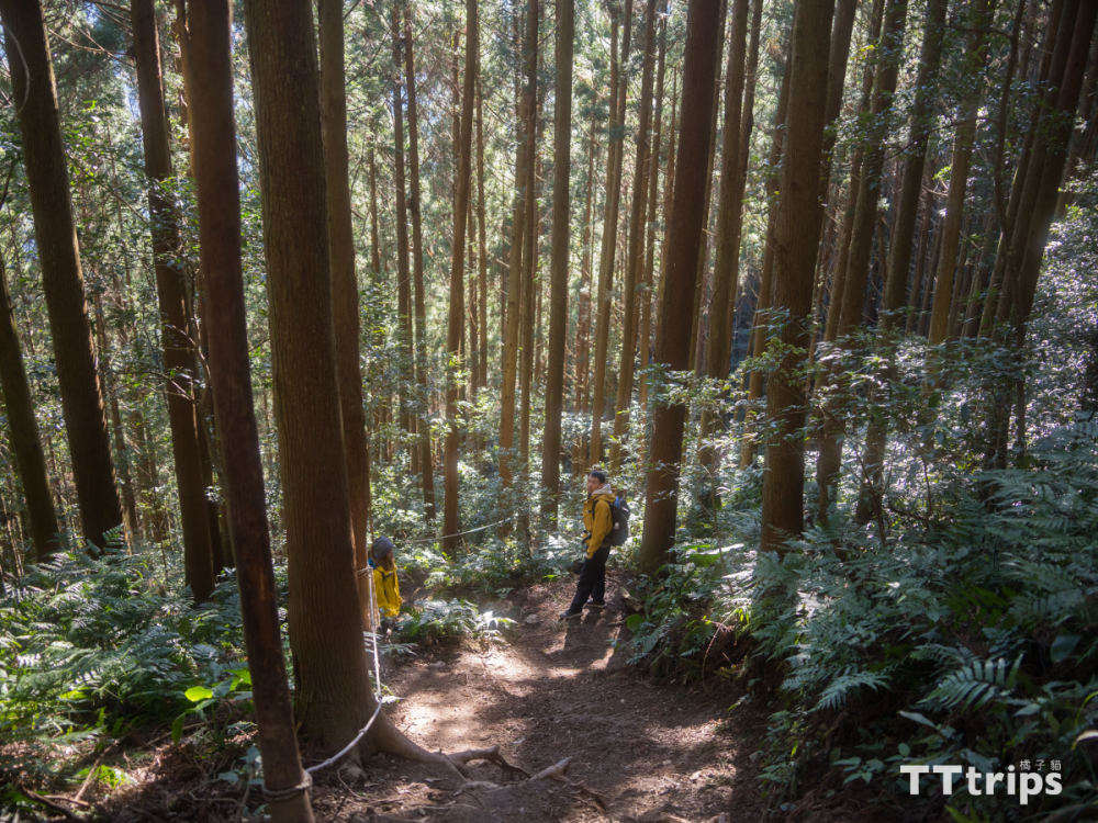
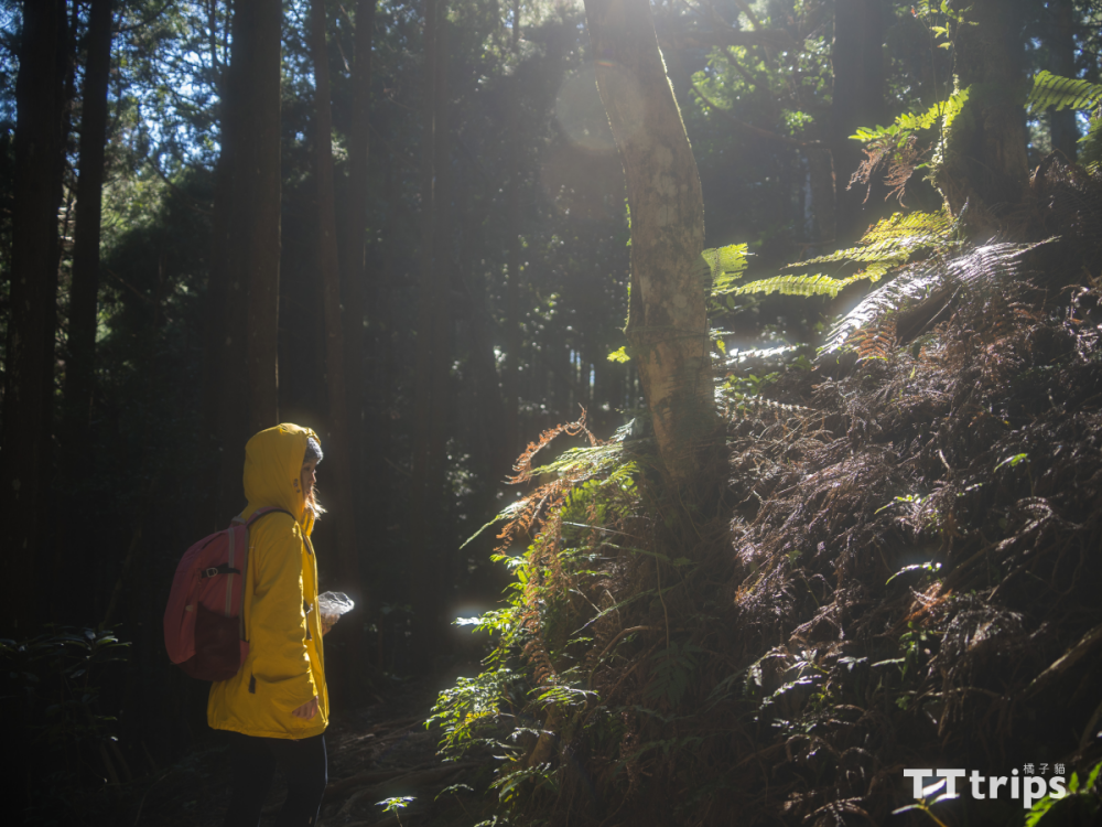
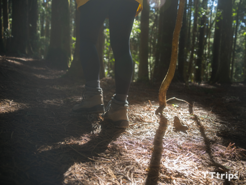
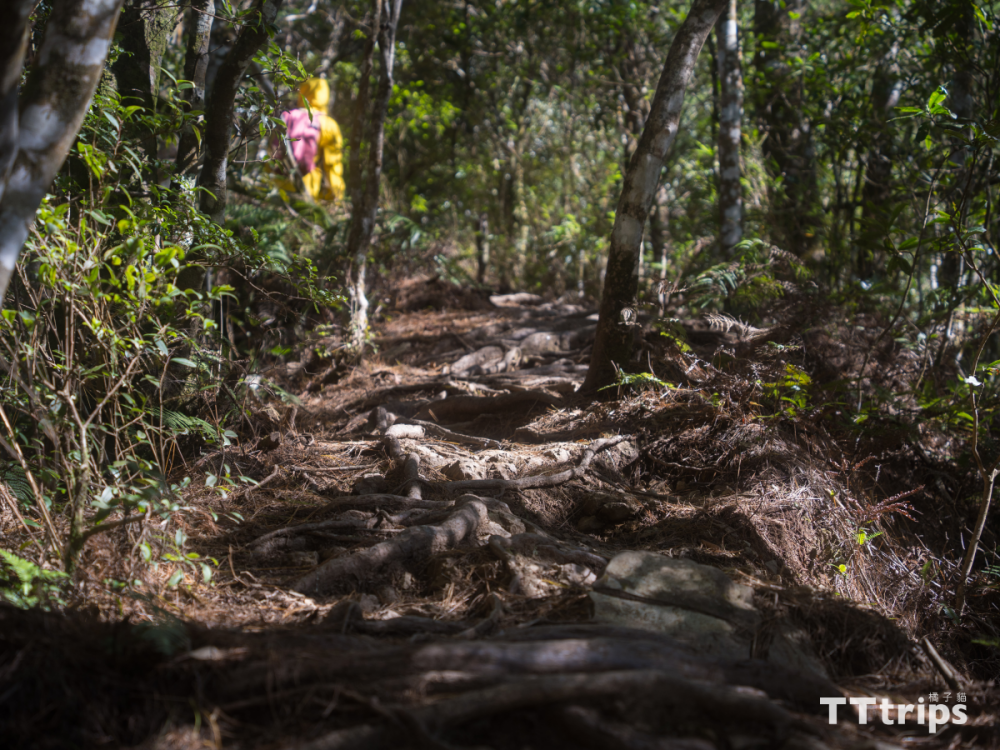
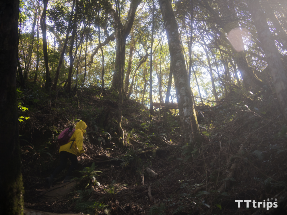
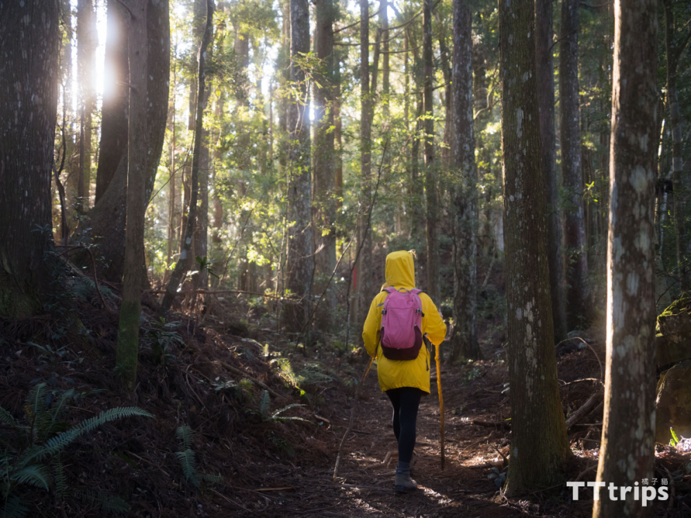
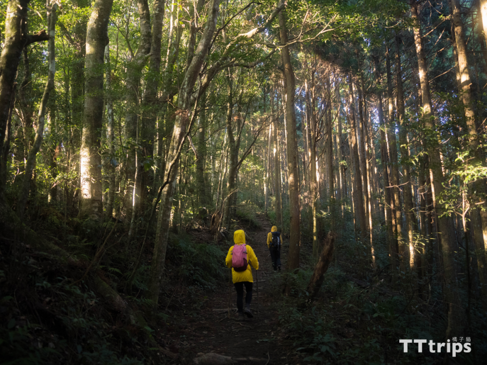
After "taking the right to enter" from the mountain entrance, it is a steep uphill that requires both hands and feet. There are ropes to assist along the way. It is recommended to do some warm-up exercises before climbing to avoid strains. As the altitude climbs, the breathing becomes short, so we stopped. After taking a break, we found that we were surrounded by fir trees and my great-aunt taro fields. When we saw the magnificent fir forest, we thought we were climbing Mount Garry this time.
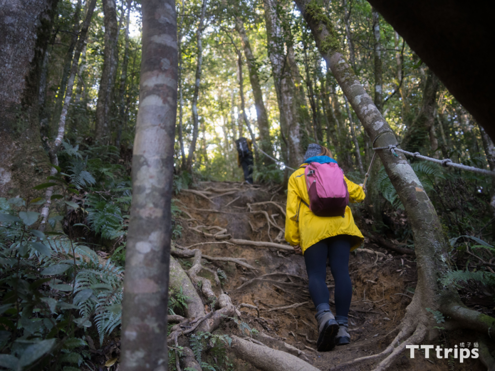
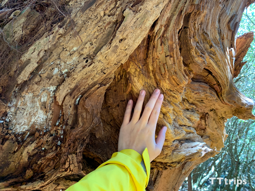
Along the way, you must photograph the hollow giant tree
.png)
Following the signs and the cloth strips on the trees, we continued to climb. We passed the second and third mountain passes along the way. After a while, we encountered a hollow tree that netizens must photograph, just enough to stop and rest.
Arrive at the Gaotai Mountain Triangle Point
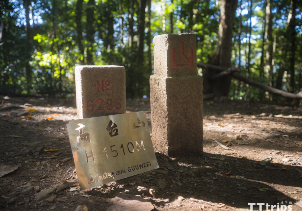
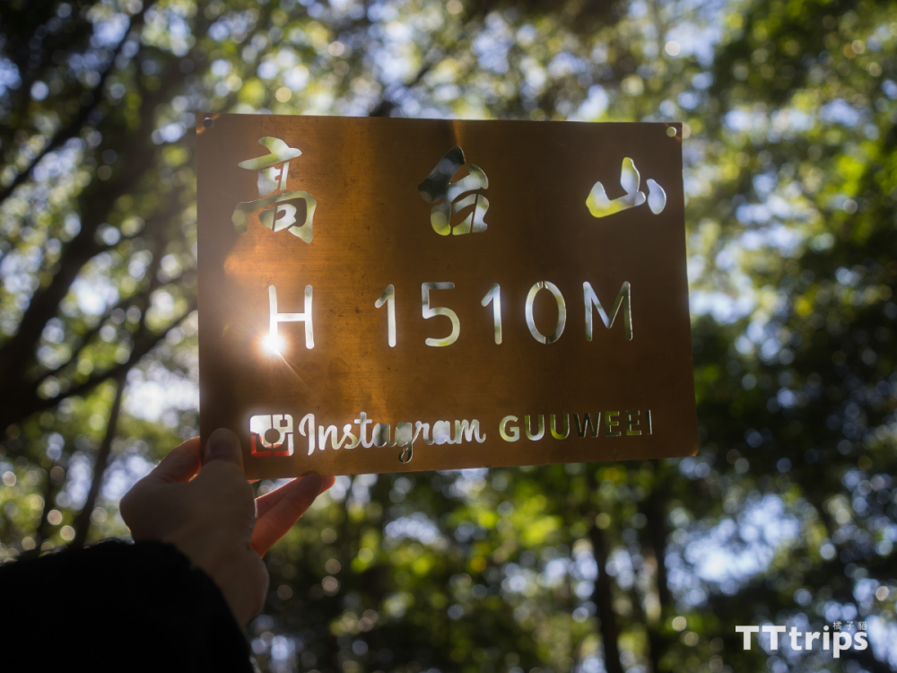
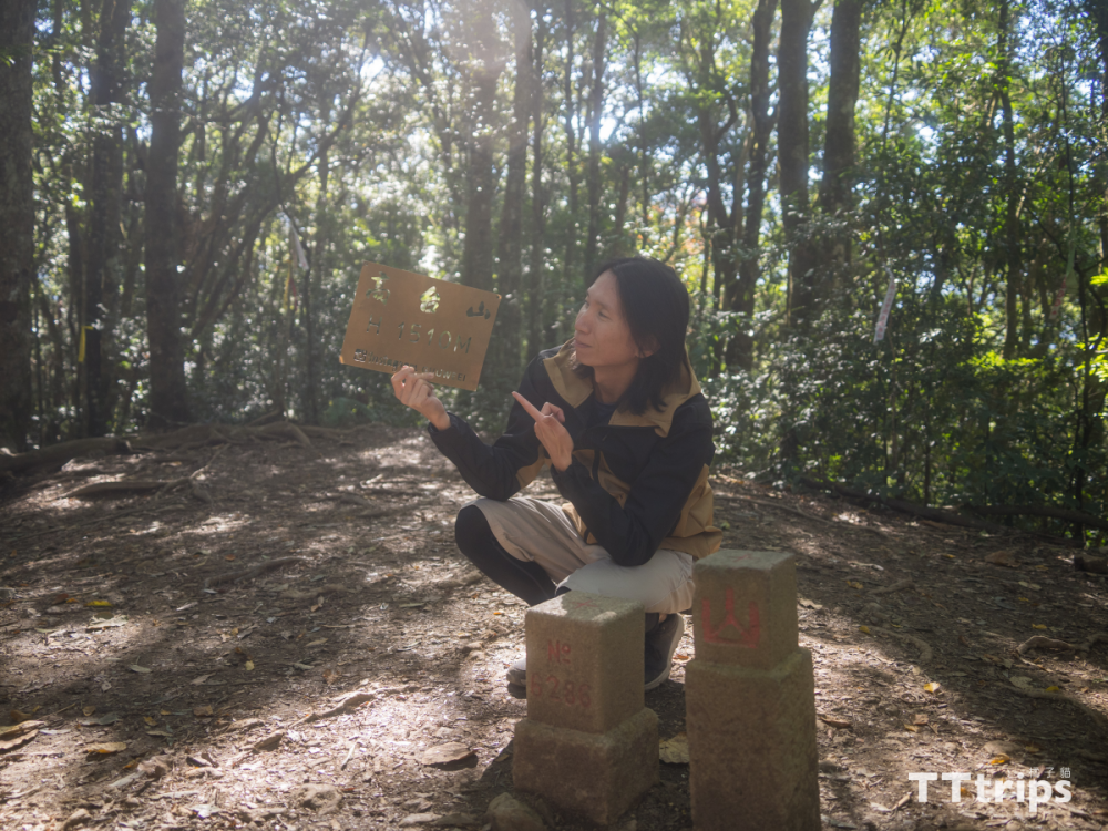
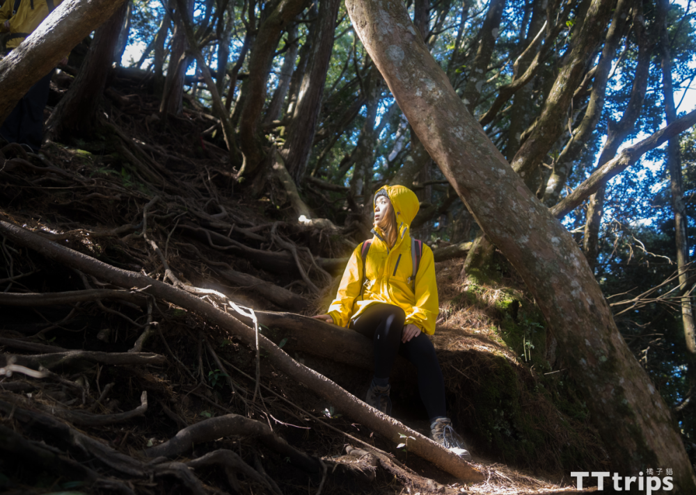
After passing the giant tree, we continued to pull the rope up steeply. We arrived at our first mountain "Gaotai Mountain Triangle Point" about an hour after entering the mountain entrance. Although there was no outlook, the weather was fine that day, and the sun shined through the cedar forest into the forest. , and take beautiful photos that you can't find in the forest trails.
Go to cedar forest camp
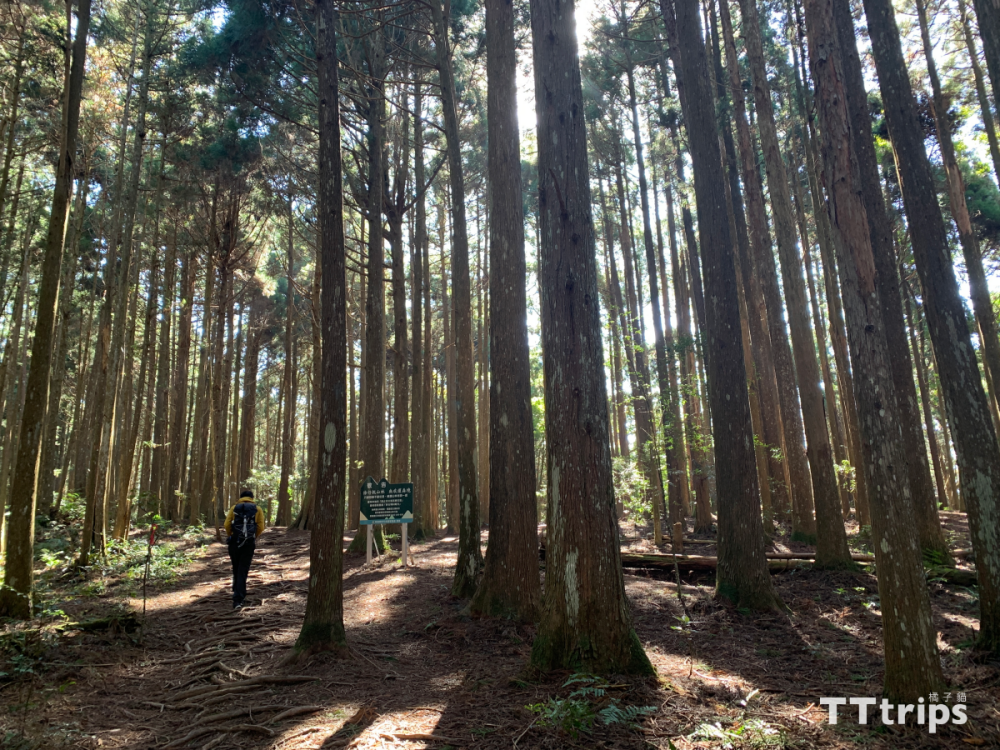
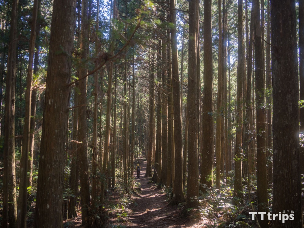
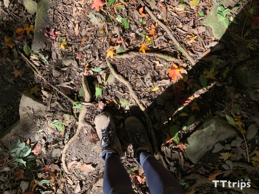
After leaving the triangle point, the trail is gentle and easy to walk along the way, and soon arrives at the cedar forest camp, which is also recognized by many netizens as a beautiful section of the vertical walk. Looking down at the natural carpet intertwined with dead leaves and tree roots, looking up is The towering and majestic fir forest, I already feel that the trip is worth it when I come here.
The steep climb before reaching the viewing platform
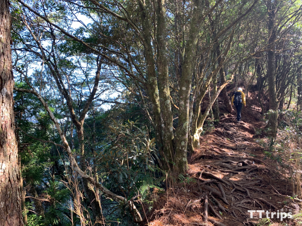
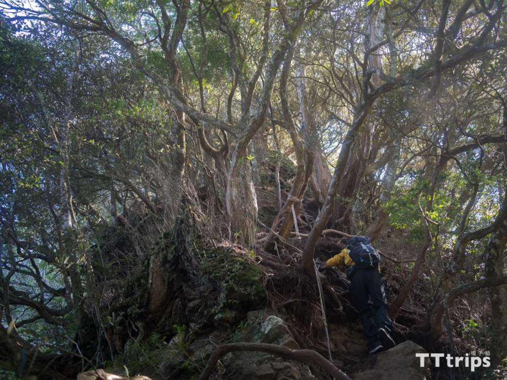
After passing through the fir forest section, it starts to climb steeply. Along the way, you can already see a wide view. We continue to climb on the trail formed by the roots of the trees. The direct trail becomes narrower and narrower, which means that you are not far from the Takashima View Terrace.
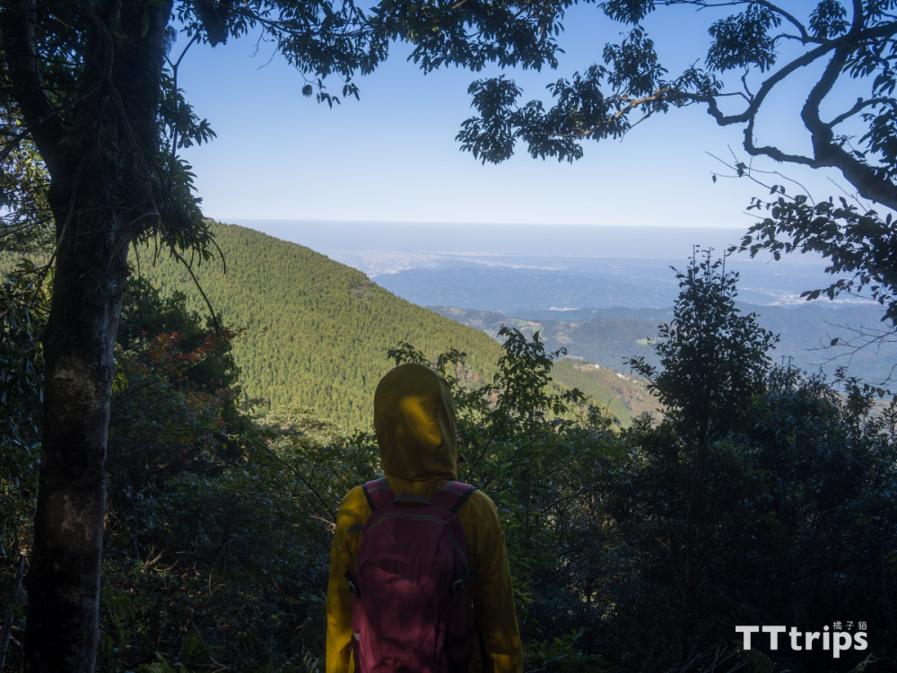
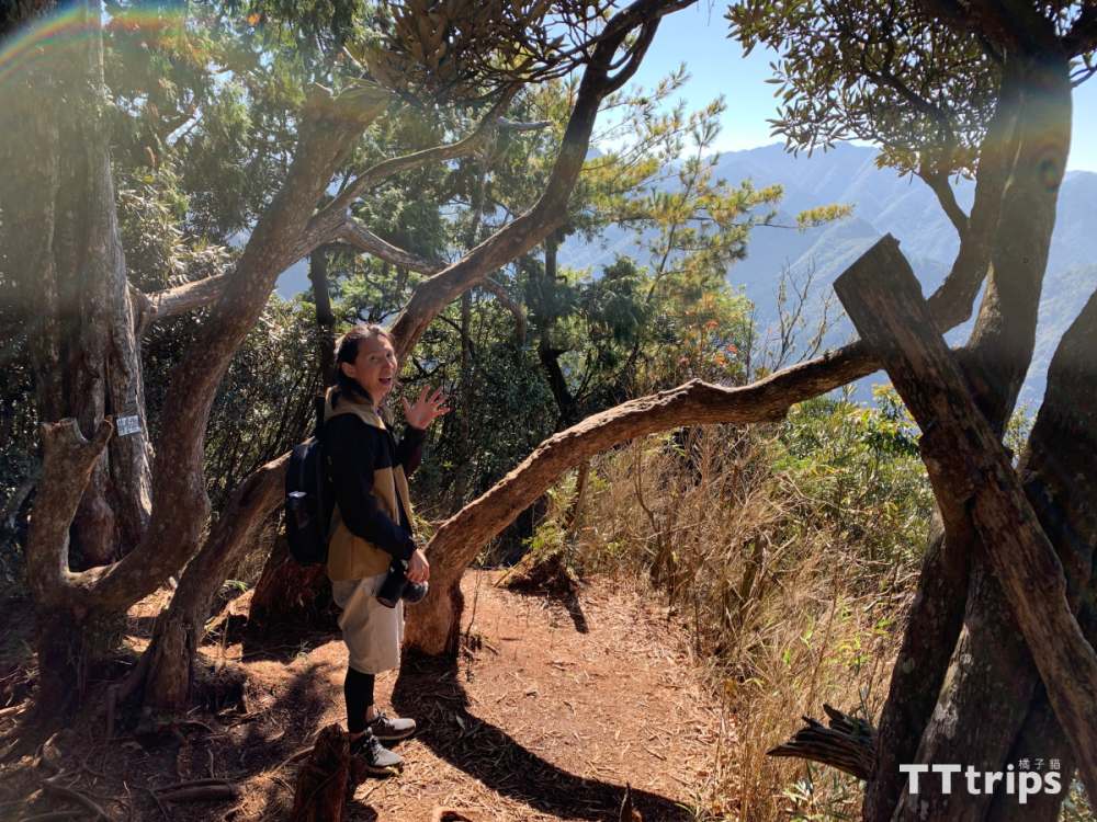
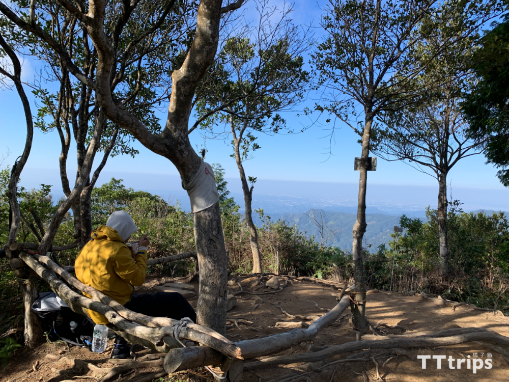
Great view from Takashima View Deck
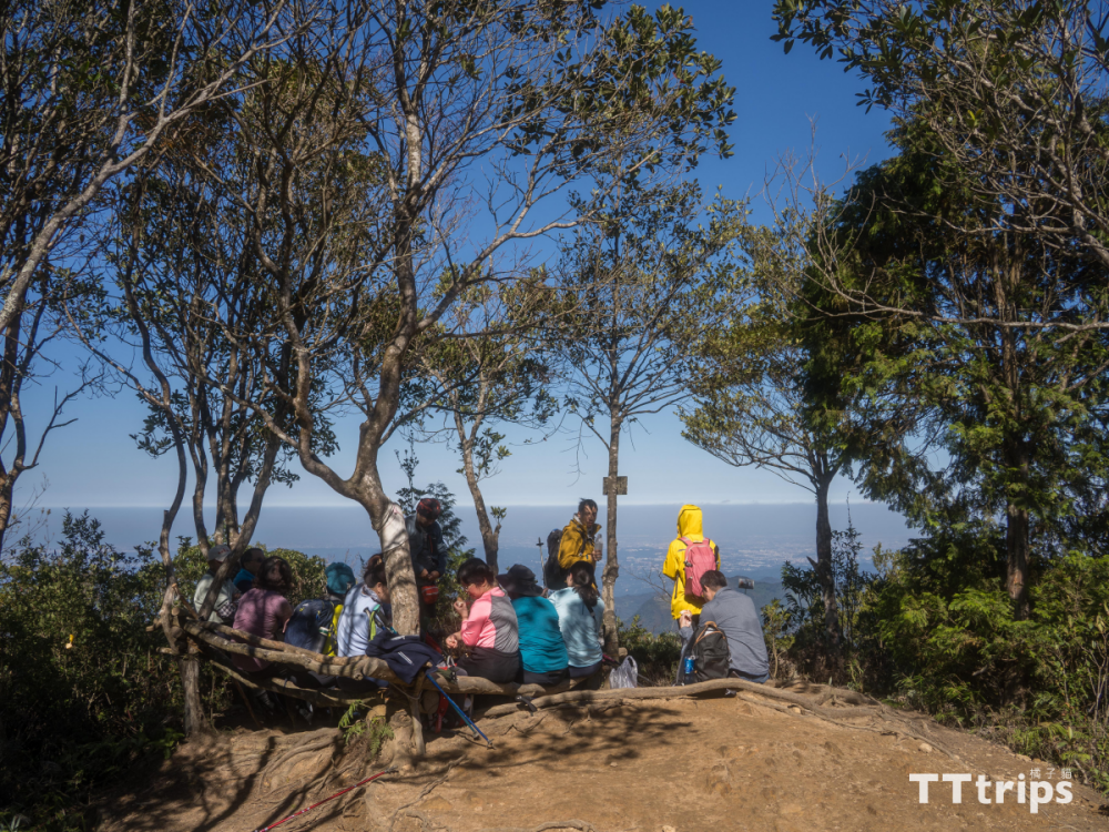
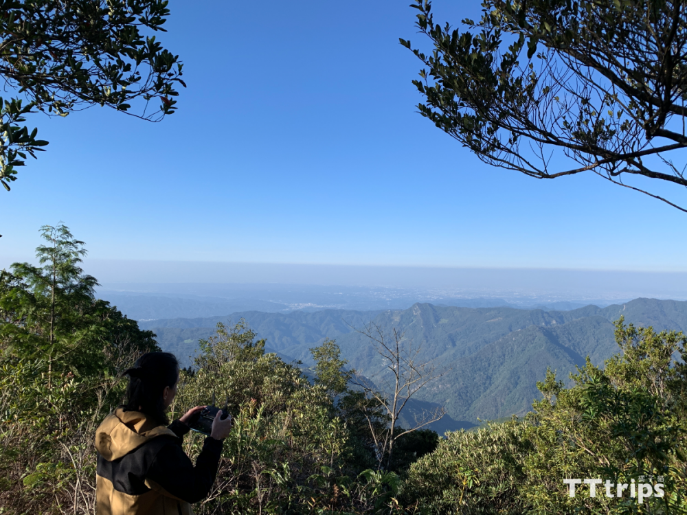
Arriving at the high island viewing platform, the view here is very broad, with a 180-degree zero dead angle view, so many people choose to have lunch here, take a break, and then continue to challenge or consider turning back, because after leaving the viewing platform, it is to go to the small, The vertical walking route of Zhong and Oshima Tianshan has been completed, so when you come here, you can also evaluate whether your physical strength is suitable for continuing to complete the vertical walking. After all, the next road will be more and more difficult to walk...
The road to Koshimada Mountain
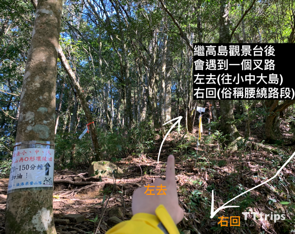
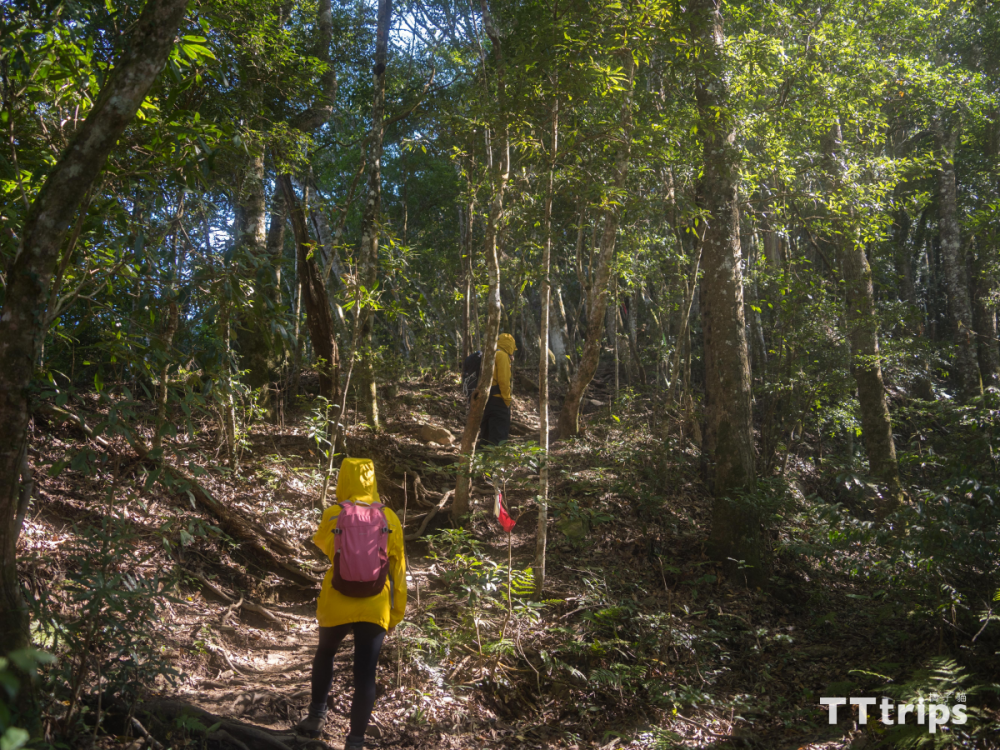
After leaving the viewing platform, you will come to a fork in the road. Going up steeply to the left is the road to the small, medium and large islands. Most people will give priority to walking around the waist, because although the right side looks easier, but when returning. There will be more difficult steep descents, so I sincerely recommend that you go left and right.
Really good "small" Shimadayama
.png)
.png)
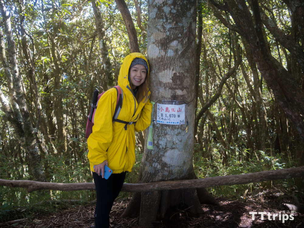
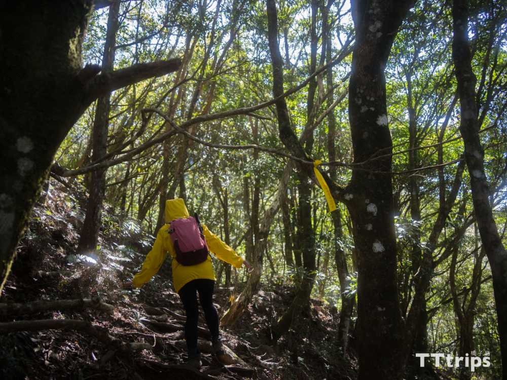
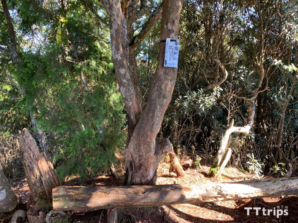
After a few climbs that are not too difficult, we arrived at "Little" Shimada Mountain. If we didn't look carefully, we might have missed it, because Xiaojieda Mountain has no outlook and no cornerstone, only a small platform and a post on The sign on the trunk, but we still commemorate it with a shadow.
The steep climb to Mt. Nakashimada
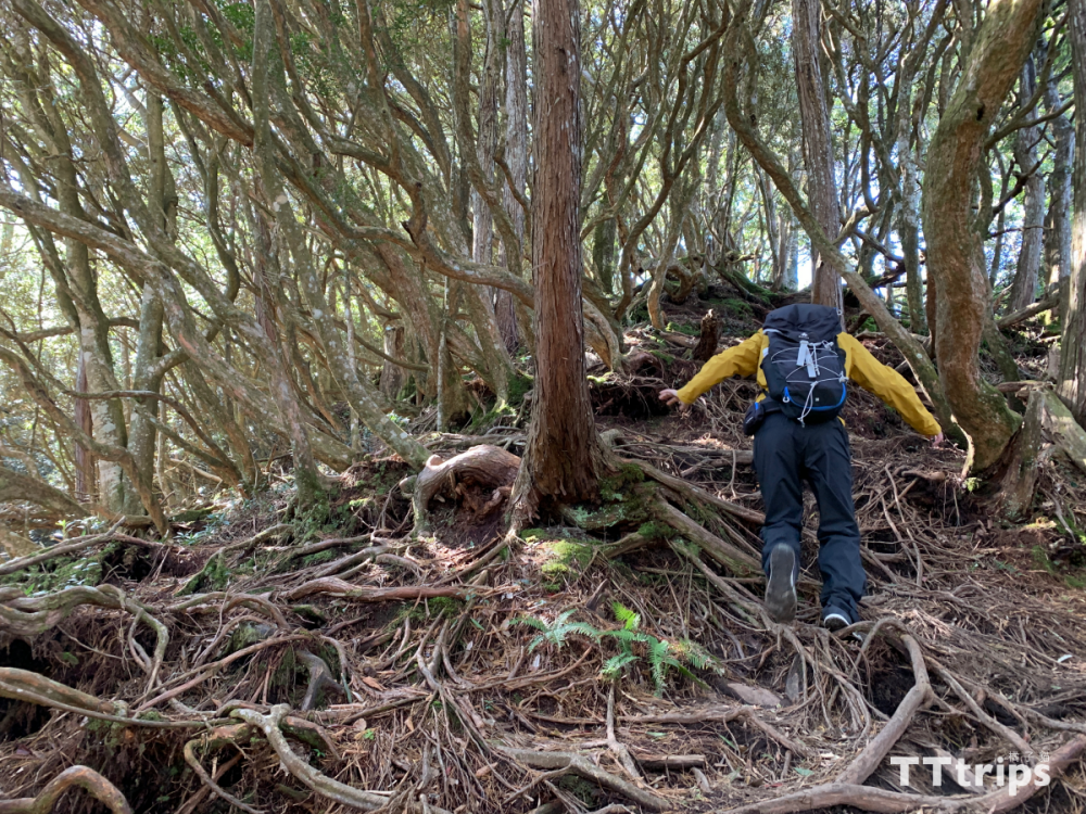
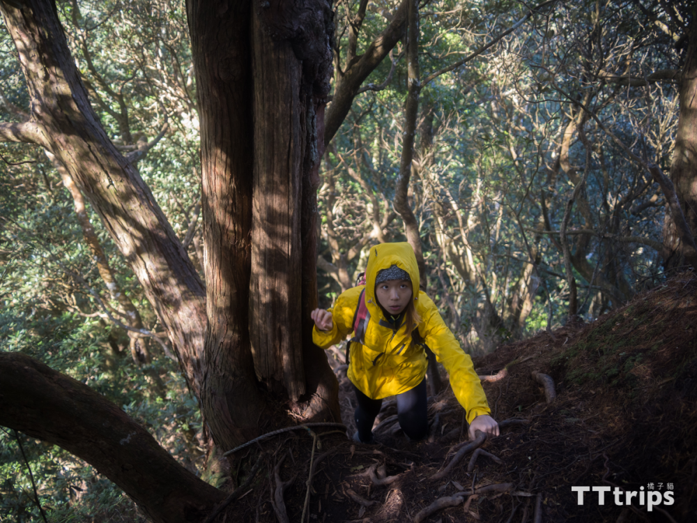
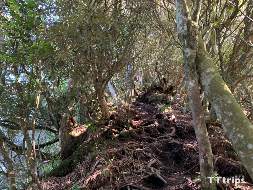
I said earlier that the climb to Kojimada Mountain is not too difficult, because on the way to Nakajimada Mountain, I realized "climbing with both hands and feet". In addition to the steep slope, the next section of the road is full of intertwined tree roots and stones. It increases the difficulty of climbing. It is not enough to use both hands and feet. You need to pay special attention to your steps, especially after it rains. It will be very slippery. Therefore, it is recommended that you bring a pair of cotton gauze gloves and shoes with strong grip to increase friction and wear the right equipment. Do more with less.
The view of Nakashimada Mountain
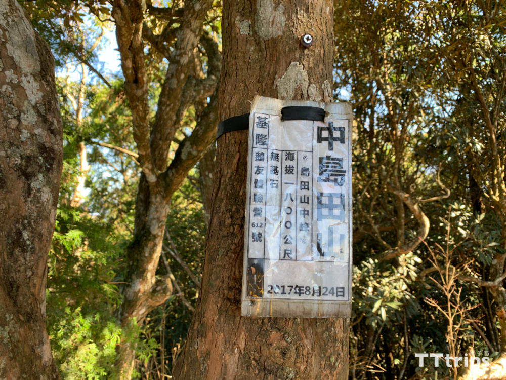
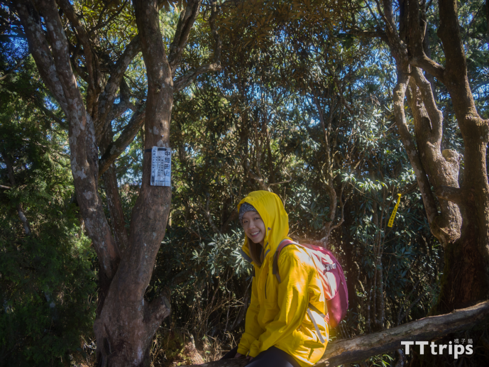
After passing through the numerous rhododendron forests, we finally arrived at Nakajima Tianshan, which is 1,800 meters above sea level. Although the hinterland of Nakajima Tianshan is not large, you can see the mountain scenery, and there is a horizontal trunk lying between the two trees. You can sit down and rest. After the very difficult climb in front, remember to take a break here to replenish your physical strength and food, because the road to Oshimada Mountain is not to be underestimated.
The last steep climb to Mt. Oshimada
After the rest, continue to set off. After the front climbs and supports it, you can easily control the steep slope of Oshimada Mountain, but the more you go up the road, in addition to the steepness, it becomes narrower and narrower, so you can't be careless. Go slowly.
The last Oshimada mountain
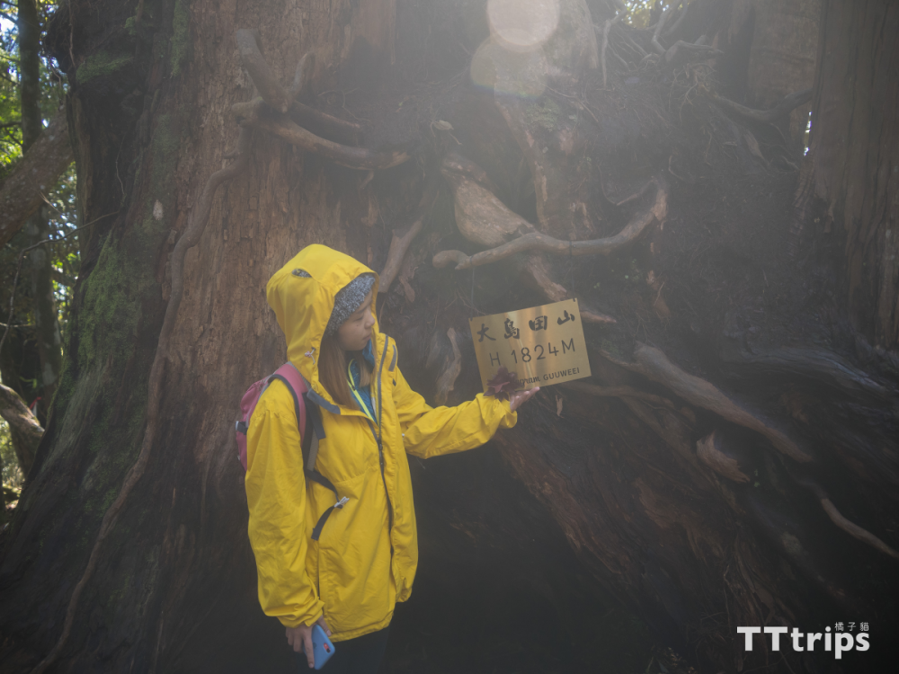
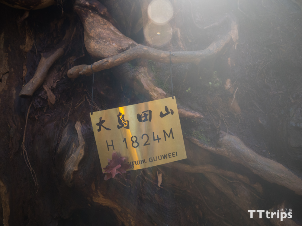
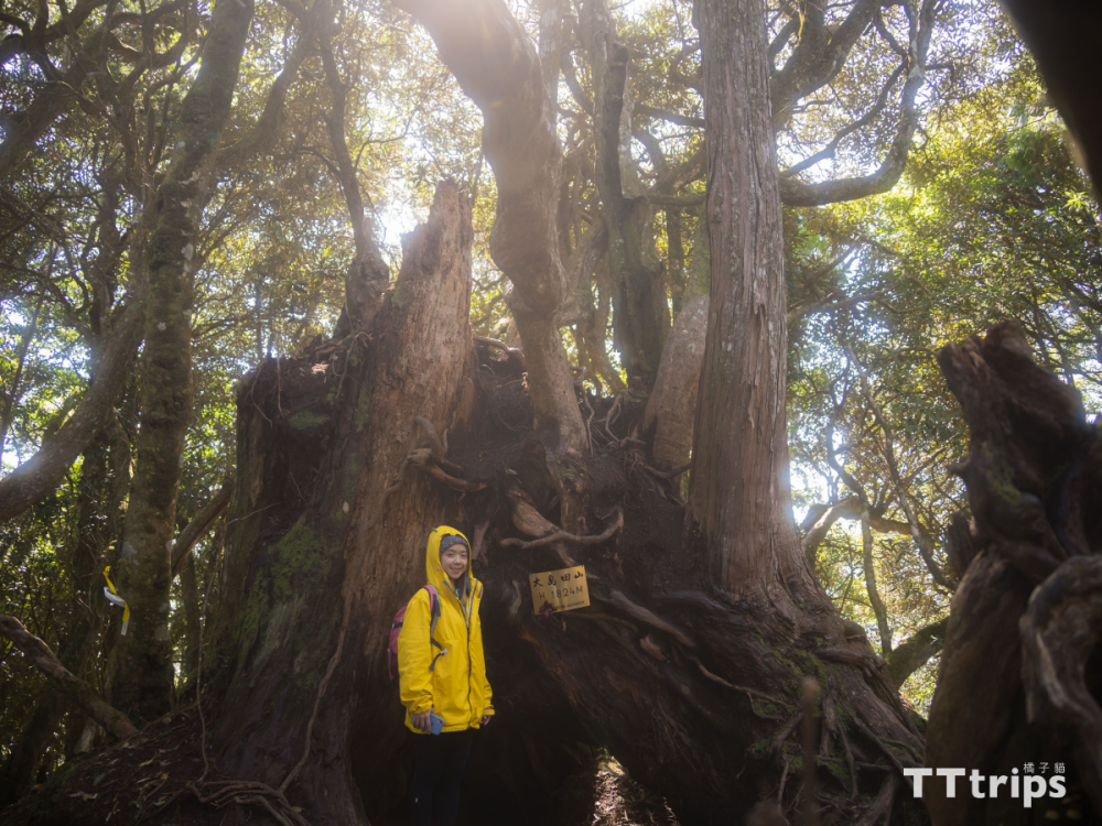
When you climb up and see a huge cypress tree with a second generation tree growing above it, it means that Oshimada Mountain has arrived. This is one of the must-see scenery for vertical walking. It is very special because this is also the last part of Takashima vertical walking to be subdued. a mountain. Although it is "big" Shimada Mountain, the hinterland is still not big, so we went straight down the mountain after taking pictures.
Various healings on the downhill section
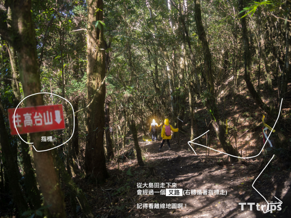
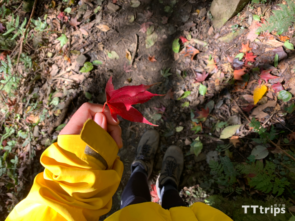
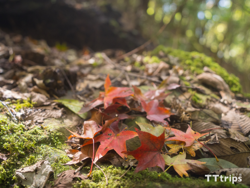
We entered from the left side of the fork when we went to Kojima Tianshan just now. Now we will exit from the right side when we go down the mountain. After coming down from Oshimada Mountain, we will encounter a fork in the road. Remember to turn right and follow the signs. If you are not sure about the route, you can open the offline map to confirm. After walking for about ten minutes, we were lucky to encounter a large maple forest area. The red, orange, yellow and green maple leaves covered the ground, and the tired journey down the mountain was healed.
Gentle slope in front of the O-shaped fork
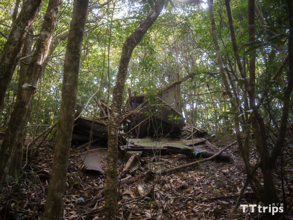
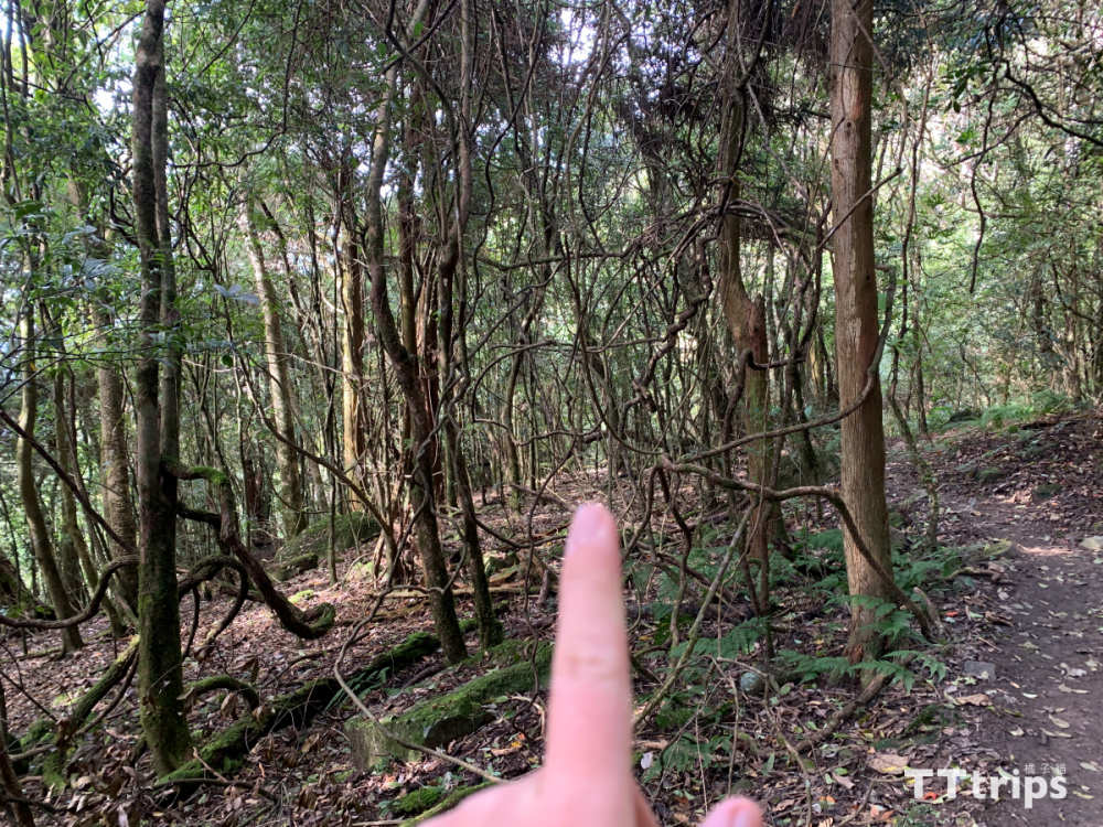
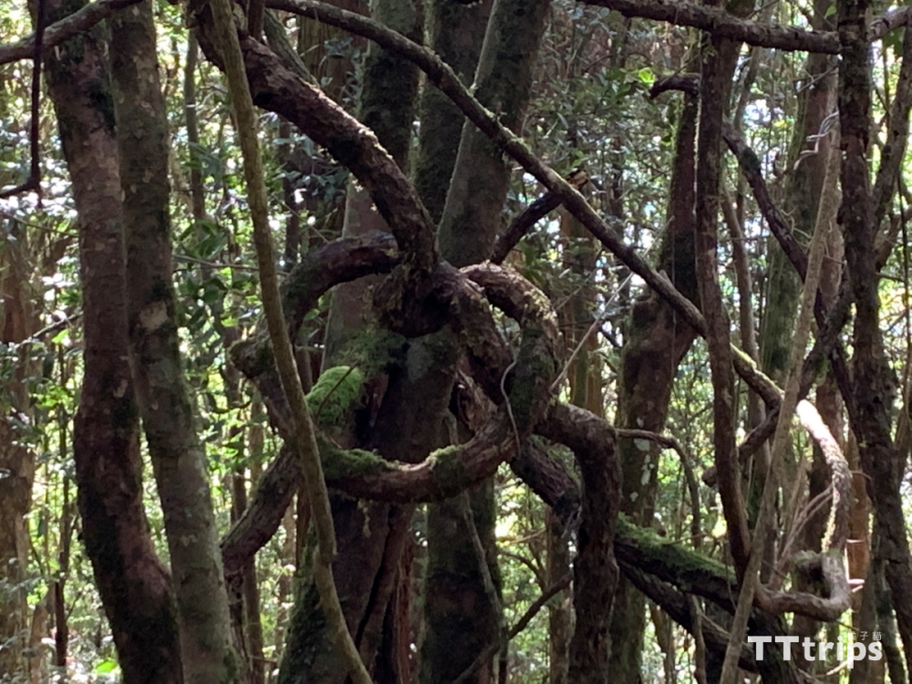
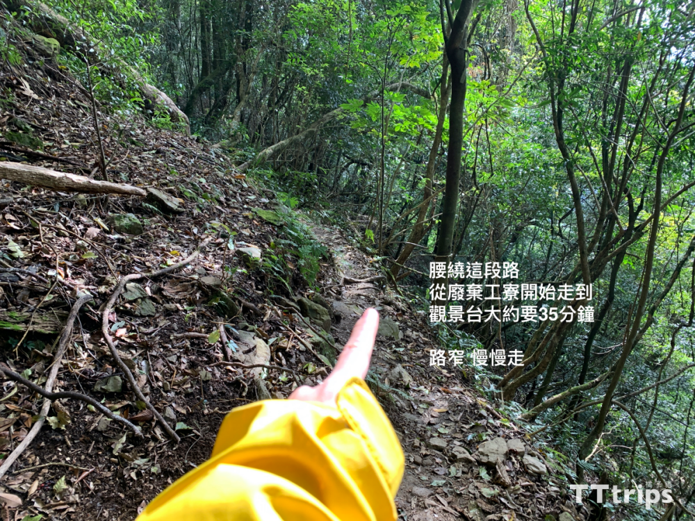
The first half of the downhill slope is quite easy to walk. On the way, you will pass an abandoned factory building, which means that you have not taken the wrong way. Next, go all the way down. If you have enough time, don’t forget to stop and take a look at the surrounding scenery. , like this time, we found branch art that has never been shared by Shanyou, as well as branches that seem to be in the shape of love. It takes about 35 minutes to go to the viewing platform after leaving the factory. The road is very narrow and remember to walk slowly.
Backtrack
After returning to the fork in the road, we turned back to the Takashima Observation Deck. We had plenty of time to descend the mountain and the weather was very good, so we chose to have lunch here. Take a break. The return journey is to take the original road: Takashima Observation Deck > Liushanlin Camp > Gaotai Mountain Triangle Point > Climbing Entrance, so while going down the mountain, we stopped again to appreciate and reminisce about the scenery we just missed when we were rushing up the mountain, and finally Accompanied by Xizhao, we proceeded smoothly towards the trailhead. Gaotai, Kojima, Nakajima, and Oshimada Mountains, we will see you next time.